Tobias Hobbs
Year 1 MArch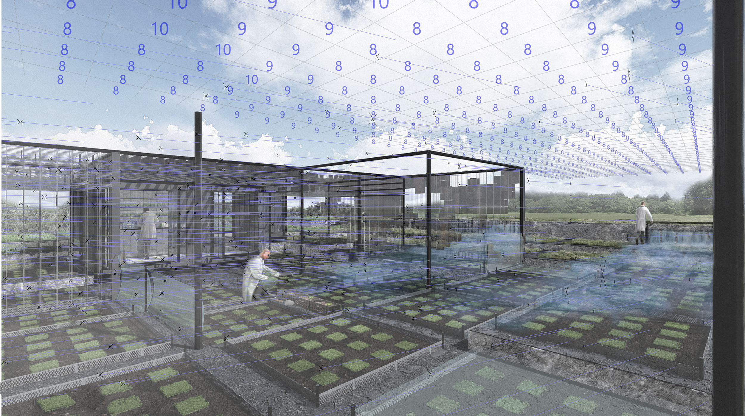
Land of the Moss Voxel
Informed
Strategies of
Sphagnum
Moss Flow
Fens, UK
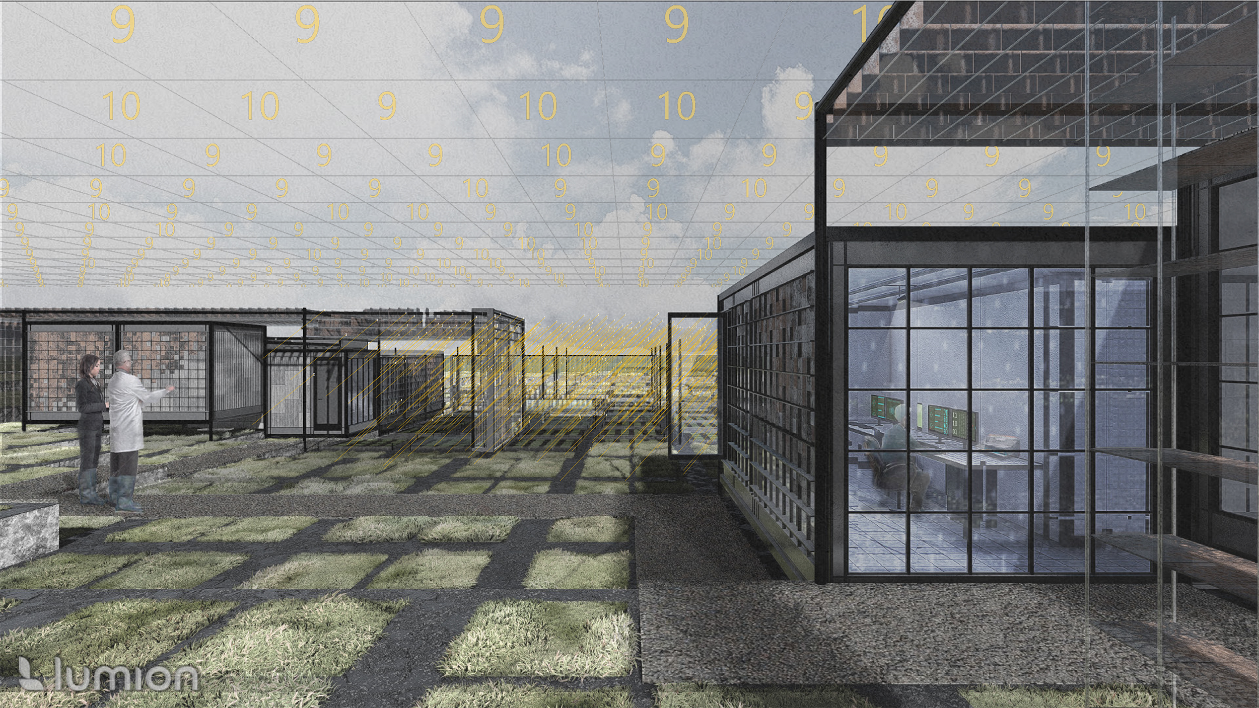
Land of the Moss is a project that explores the flows of growth patterns of sphagnum moss and its relation to land that is used to inform agrarian data strategies to farm moss autonomously supported with wetted paludiculture systems. Moss growth research is also integrated into the complex. Achieved through a series open, mild microclimate facilities to identify growth patterns of certain species to help inform future moss farm expansions and strategies.
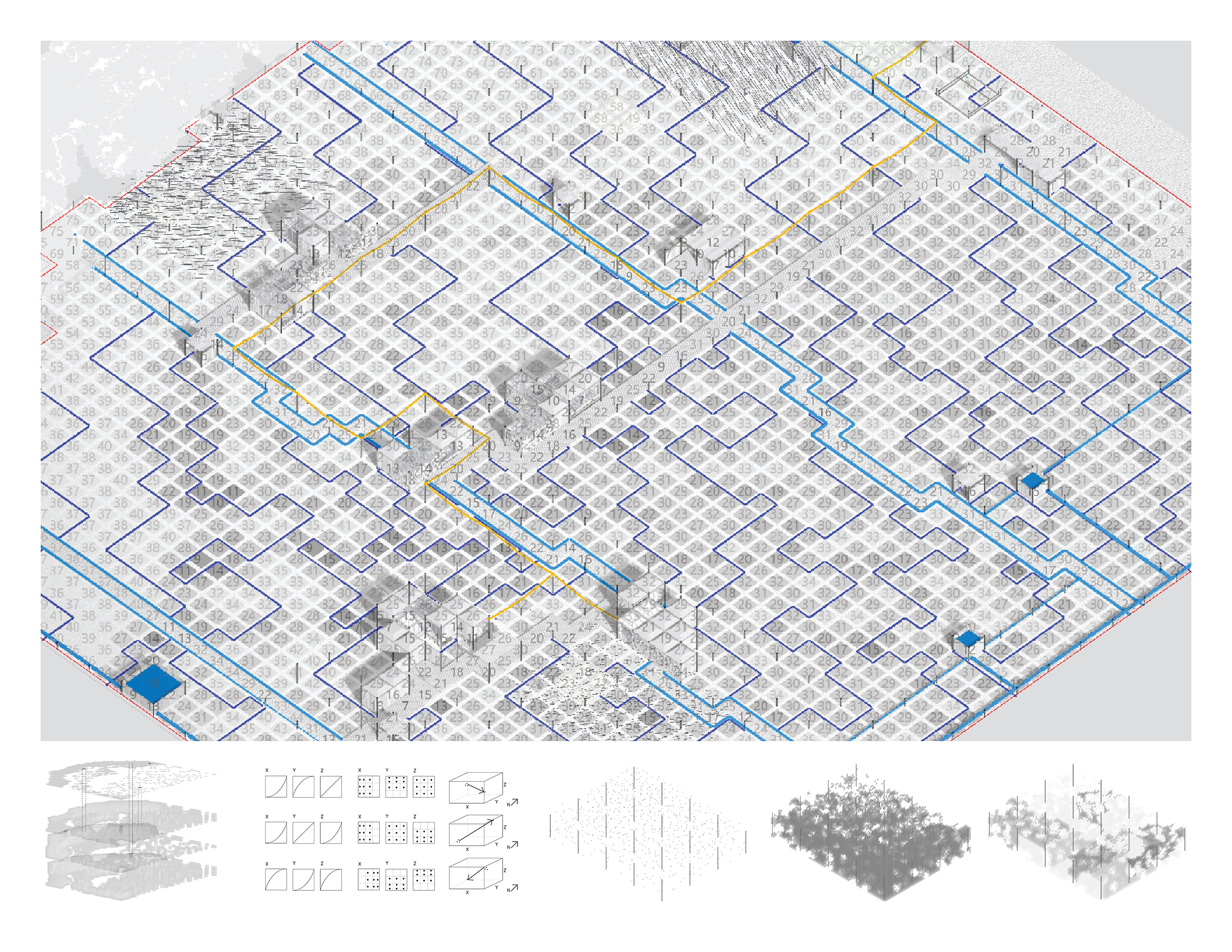
Sphagnum is a species of moss with a reproductive system dependent upon water intake, due to the lack of a stomata. Saturated grounds and humid areas lend ideal conditions for sphagnum moss to grow. Thus, the lowlands of the Fens, an optimal location for moss farms. This relationship between the flows of moss growth, environmental conditions and landscape explored to form the basis of the design strategy. A series of simulated environmental studies of the site: saturation, temperature, light, humidity and wind, converted into flat pixelated images. Each individual pixel extruded by its numerical value to create a voxelated data set. Derived from layering growth factors proportionately, whereby saturation is of higher value, and wind low. This growth metric became a tool for the project, identifying high to low growth spots that inform building locations, open research facilities and optimal paths of autonomous cultivation.
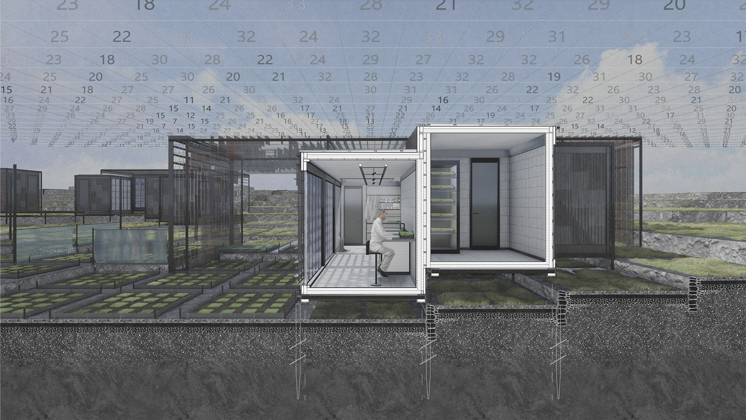
The research, farming facilities and landscape is confined to 2.5m square setting out, in direct relation to the derived data set. Microclimate articulation is achieved through computational methods that use point and vector gradient densities, that act as repellents and create organic voxelisation. The sloped landscape also utilises a voxel concept. Inspired by the Incay Moray, it is contoured to help magnify the environmental factors of each microclimate research facility. A variation of wet farming (paludiculture), the landscape uses an integrated water system. Whereby water routes are computationally derived using a collapsed wave function, to ensure an even distribution of saturated land.


︎︎︎ Home
︎︎︎ Previous // Next ︎︎︎